Here's just a small sampling of our recent projects.

High resolution orthophoto showing a damaged section of the jetty
Coos Bay North Jetty Aerial Mapping, Coos Bay, Oregon
This project for the USACE Portland District involved aerial mapping to support jetty repair engineering activities. We prepared topographic mapping and orthoimagery using very high imagery (2 cm) and prepared a fused data set combining photogrammetrically derived upland topographic surface with bathymetric data collected by project teammates. The expected point density was nearly 2,200 points per square meter. Following point cloud generation, we classified the points as either ground or non-ground and collected photogrammetric breaklines to ensure an accurate terrain model. These data were fully integrated with bathymetric data to provide a combined overall surface model for use in designing the jetty repairs and estimating construction quantities.

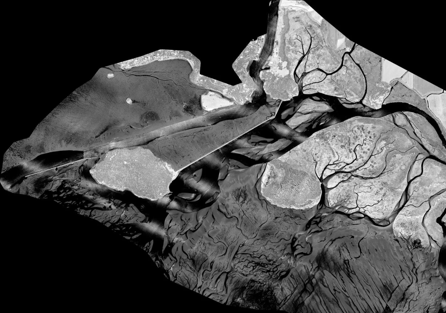
Orthophoto showing the confluence of the North Fork and Middle Fork of the Snoqualmie River
King County Water and Land Resource Division - North and South County Lidar and Orthos, King County, WA
To document changes in the river channels and floodplains as the result of a large flood event, we provided photogrammetric services that combined aerial imagery, lidar data and bathymetric data. The aerial imagery and lidar data were acquired for multiple river basin areas of interest (AOIs) with bathymetric data collected along the same areas. We merged the various data types to produce a seamless digital 3D surface and used previously collected lidar data to expedite the DTM/DEM process for orthorectification.

Tile Layout for 2015 King County Orthoimagery Program
2015/2019 King County QA/DAT for Regional Orthoimagery Programs, King County, WA
These projects are testimony of our company’s commitment to quality. In 2015, we served as the sole source QA/DAT contractor for King County’s 2015 regional orthophoto program (3,900 square miles )program and is currently serving as the QA/DAT contractor for the 2019 program. In this role, we evaluate the quality of the image acquisition, analytical aerotriangulation (A/T) solutions, and pilot imagery deliverables; and reviews each of the orthophoto tiles. In addition to manual review, we use an internally designed automated process to review each tile for a variety of possible defects. This automation is critical in ensuring the county receives a complete, correct, and high quality final set of deliverables.